Google Earth Engine
Large-scale planetary insights with cloud-based geospatial analysis
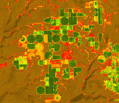
Spectral Index App
An app that generates monthly and annual composites of the most well-known remote sensing indices like NDVI and NDWI.
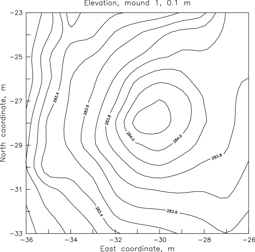
Contour Lines Generator
A tool that creates 10-meter contour lines using interpolation of Digital Elevation Models over areas of interest.
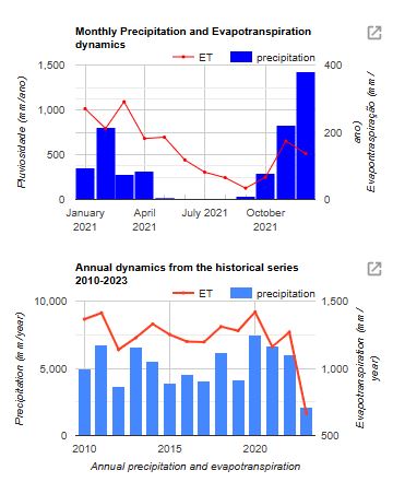
Climatological Data App
Web application to visualize monthly and annual climatological data from various sources at any part of the world.